
Travel Planner

“Shorelines & Small Towns”
Episode #2307 Travel Planner
Join us for a scenic journey across Michigan’s Upper Peninsula, where quiet shorelines, forested landscapes, and small-town charm come together. From outdoor adventure to rich local history, it’s a trip filled with natural beauty, welcoming communities, and unforgettable Great Lakes views.

Comments
Tell us what you thought of this episode and get information about the areas featured by filling out the comment form
Comment Form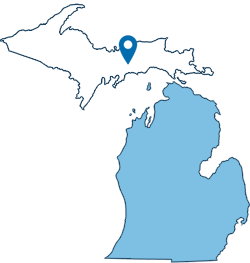
Michigan's Upper Peninsula

Michigan's Upper Peninsula

Location: Michigan, USA
Michigan's Upper Peninsula (U.P. or "Yoop") is a pristine, rugged region covering 29% of the state but containing only 3% of its population, separated from the Lower Peninsula by the Straits of Mackinac. Known for incredible natural beauty, it features Lake Superior shores, numerous waterfalls (notably Tahquamenon Falls), and dense forests, making it a prime destination for hiking, snowmobiling, and exploring, particularly around Marquette, Pictured Rocks, and Copper Harbor.
No one does spring and summer like Michigan’s Upper Peninsula. As forests turn lush and days grow longer, hundreds of miles of shoreline along Lakes Superior, Michigan and Huron—and scenic byways that connect them—invite you to explore at your own pace. From legendary national parks to quiet state park beaches, every turn reveals another reason to stay just a little longer.
- The Upper Peninsula [Pure Michigan]
Mackinac Island

Location: Lake Huron, between Michigan's Upper and Lower Peninsulas
Phone: (906) 847-3783
FORT MACKINAC
Location: 7127 Huron Road - Mackinac Island, MI
Phone: (906) 847-3328
Mackinac Island offers timeless charm with its horse-drawn carriages, historic architecture and attractions. For centuries, visitors have found this national landmark to be the ideal vacation spot. No cars. No chain hotels. Just world-famous Mackinac Island Fudge, historic Fort Mackinac, unique shopping and diverse dining. Unforgettable sunsets, awe-inspiring sunrises and over 70 miles of hiking and biking trails befit their ranking as the #1 Island in the Continental U.S. as named by Travel & Leisure Magazine.
More than just a military outpost, Fort Mackinac served as a home for soldiers and their families and eventually the headquarters for Mackinac National Park, where tourists to the island visited the great fortress on the bluff, much like they do today. The cannon blasts, the rifles fire, the soldiers march and history comes alive. The oldest building in Michigan and 13 other historical structures boast exhibits explaining everything from military training and battles to medical treatments to family life within the fort.
- Mackinac Island
- Fort Mackinac [Mackinac State Historic Parks]
Mackinac Bridge

Location: on Interstate 75 at the Straits of Mackinac
Toll: $2 per axle for passenger vehicles ($4 per car). $5 per axle for motor homes, and commercial vehicles.
Phone: (906) 643-7600
The Mackinac Bridge is a suspension bridge spanning the Straits of Mackinac to connect the Upper and Lower peninsulas of Michigan. Opened in 1957, the 8,614-foot "Mighty Mac" is the world's fifth-longest in total suspension and the longest suspension bridge between anchorages in the Western hemisphere. The Mackinac Bridge connects the city of St. Ignace on the north end with the village of Mackinaw City on the south.
The Straits of Mackinac are the short waterways between the U.S. state of Michigan's Upper and Lower Peninsulas, traversed by the Mackinac Bridge. The main strait is 3+1⁄2 miles wide with a maximum depth of 295 feet, and connects the Great Lakes of Lake Michigan and Lake Huron.
US-2 Top of the Lake Pure Michigan Byway

Location: 92 Miles along north shore of Lake Michigan from St. Ignace to Thompson, Michigan
Part of US Highway 2 is the newest highway segment to be designated a Pure Michigan Byway under the state's rebranded byway program. The US-2 Top of the Lake Byway runs 92 miles from St. Ignace to Thompson, hugging the picturesque northern shoreline of Lake Michigan. It was chosen for the designation based on its outstanding recreational and scenic qualities.
- Pure Michigan Byways Program [MDOT]
- Dedication Ceremony Videos [Manistique Tourism]
Sault Ste. Marie

Location: Sault Ste. Marie is located at the northern end of I-75 in Michigan's Upper Peninsula. Exit 392 enters onto the I-75 Business Spur at the city limits, and Exit 394 enters onto Easterday Avenue in downtown Sault Ste. Marie.
Phone: (906) 632-3366
SOO LOCKS BOAT TOURS
Location: 515 East Portage Avenue - Sault Ste. Marie, MI 49783
Phone: (906) 632-2512
Open: May - October (Check Website for Full Schedule)
Sault Ste. Marie is one of the most popular vacation destination in Michigan’s Upper Peninsula for some very good reasons. With year round recreational activities, historical sites, the world-famous Soo Locks, Tahquamenon Falls, and spectacular lighthouses, forests and waters. And don't forget there is some of the best fishing on the St. Mary's River. There is always something to do in “The Soo”.
Famous Soo Locks Boat Tours provides an educational tour of historic Sault Ste. Marie and an engaging experience of passing through the Soo Locks. Proudly operating since 1959, Famous continues the tradition of highlighting history and attractions for a relaxing and memorable experience for locals and visitors. Our yellow and blue boats, the Nokomis and LeVoyageur, accommodate 150 passengers and feature a full snack bar with beer, wine and hard seltzers.
Lake Superior

Location: northernmost and westernmost of the Great Lakes bordering Michigan, Minnesota, Wisconsin and Ontario
Size: 350 miles by 160 miles, 2.903 cubic miles of volume
Located above Michigan’s Upper Peninsula, Lake Superior is the largest freshwater lake in the world by surface area and third-largest by volume. ‘Superior’ describes not only its size and volume, but also its setting. The Ojibwe called it Kitchigami, meaning “great lake.” In the 1600s it was called Le Lac Superior, or “upper lake,” by the French missionaries, denoting its location at the top of the Great Lakes region. The southern shore of Lake Superior between Grand Marais, Michigan, and Whitefish Point is known as the "Graveyard of the Great Lakes"; more ships have been lost around the Whitefish Point area than any other part of Lake Superior.
- Lake Superior [Pure Michigan]
Whitefish Point

Location: 18335 N Whitefish Point Road - Paradise, MI 49768
Phone: (888) 492-3747
Open: May - October
Whitefish Point is located at the extreme southeastern end of Lake Superior. It is a critical turning point for all vessel traffic entering and leaving this largest of all the Great Lakes. The site was placed on the National Register of Historic Places in 1973, but there was no money for restoration. In 1980, Whitefish Township approached the fledging Great Lakes Shipwreck Historical Society for assistance in preserving this important property. The Society obtained a License from the Coast Guard in 1983 to commence museum operations; opened the first exhibits in 1985; and opened the present Shipwreck Museum Building in 1987.
Lighthouses

Location: across Michigan's Upper Peninsula on the shores of Lake Superior, Lake Michigan and Lake Huron
Scattered along the shoreline, Michigan’s lighthouses offer waypoints to those on water and are landmarks of history for those on land. Michigan has more lighthouses than any other state and all of them have a unique look and story, making it the perfect place for a summer lighthouse tour. Lake Superior is home to over 30 lighthouses in Michigan.
- Lighthouses [Pure Michigan]
- "Guardians of the Great Lakes" Online Travel Planner [Great Getaways]
Seney National Wildlife Refuge

Location: 1674 Refuge Entrance Road | Seney, Michigan 49883
Phone: (906) 586-9851
Visitor Center: Open May 15th - October 20th | 9am - 5pm Daily
The refuge Headquarters and Visitor Center are located on Highway M-77 approximately 3 miles north of Germfask, Michigan and 15 miles northwest of Curtis, Michigan. It is one of the best wildlife excursions you can make, it is managed by the U.S. Fish and Wildlife Service. Seney National Wildlife Refuge is located in the east-central portion of Michigan’s Upper Peninsula, halfway between Lake Superior and Lake Michigan. The 95,238 acre refuge encompasses the 25,150 acre Seney Wilderness Area, which contains the Strangmoor Bog National Natural Landmark.
Seney National Wildlife Refuge was established in 1935 for the protection and production of migratory birds and other wildlife. Today the Refuge is comprised of a rich mosaic of marshes, swamps, bogs, grasslands, and forests. Nearly two-thirds of the Refuge is classified as wetland. Visitors may encounter the cry of the loons, statuesque sandhill cranes, nesting bald eagles, playful otters and industrious beaver living on over 95,000 acres of diverse habitats which provide a home to a wide variety of plant and wildlife species.
- Seney National Wildlife Refuge [U.S. Fish & Wildlife Service]
- Seney National Wildlife Refuge [Facebook]
- Seney National Wildlife Refuge [Visit Manistique]
Kitch-iti-kipi (The Big Spring)

PALMS BOOK STATE PARK
Location: M-149, Manistique, Michigan 49854 (a mile north of the Co Rd 455 junction)
Approximate Size: 388 Acres
Palms Book State Park, located at the north end of Indian Lake in Michigan's Upper Peninsula, is home to Kitch-iti-kipi or "The Big Spring." Palms Book is a rewarding side trip for the vacationer touring the Upper Peninsula, for here can be seen one of Michigan's alluring natural attractions -- Kitch-iti-kipi, The Big Spring. Two hundred feet across, the 40-foot deep Kitch-iti-kipi is Michigan's largest freshwater spring. Over 10,000 gallons a minute gush from fissures in the underlying limestone. The flow continues throughout the year at a constant 45 degree Fahrenheit. By means of a self-operated observation raft, visitors are guided to vantage points overlooking fascinating underwater features and fantasies. Ancient tree trunks, lime-encrusted branches and fat trout appear suspended in nothingness as they slip through crystal waters far below. Clouds of sand kept in constant motion by gushing waters create ever-changing shapes and forms, a challenge to the imagination of young and old alike.
- Kitch-iti-kipi [Visit Manistique]
- Palms Book State Park [Michigan DNR]
Copper & Iron

Location: Upper Peninsula, Michigan
While timber was an economic boon to Michigan’s Upper Peninsula, the iron ore and copper rushes put this region on the international map. Pre-dating the California Gold Rush, thousands of prospectors poured into the Marquette, Gogebic and Menominee Iron Ranges and the copper-loaded Keweenaw Peninsula hoping to strike it rich. Bustling towns, iron smelting operations and shipping docks sprang up near these mines. More and more people in Europe and the Eastern U.S. heeded the cry to “Go West, young man” to the U.P. The iron ore and copper they mined built our railroads, bridges, skyscrapers, tools, utensils and Civil War, WWI and WWII weapons.
- Mines & Mine Museums [Pure Michigan]
- Copper Mine Tours [Visit Keweenaw]
Fayette Historic State Park

FAYETTE STATE PARK & HISTORIC TOWNSITE
Location: 4785 II Road - Garden, Michigan 49835
Phone: (906) 644-2603
Fayette was once one of the Upper Peninsula's most productive iron-smelting operations. Located on the Garden Peninsula at Snail Shell Harbor. When the charcoal iron market began to decline, the Jackson Iron Company closed its Fayette smelting operation in 1891. It is now a completely restored village including 22 historic buildings, museum exhibits and the visitor center, which can be toured May through October. The historic site is located in Fayette State Park.
Visitors will find a historic townsite, a modern campground, Snail Shell Harbor, a visitor center, a boating access site, a designated swim area and more. The park’s 5 miles of trails offer impressive views from 90-foot limestone cliffs that surround the harbor. Fayette Historic Townsite represents a once-bustling industrial community that manufactured charcoal pig iron between 1867 and 1891 at the tip of the Garden Peninsula. Visitors may walk through the well-preserved buildings that have been standing for 150 years and learn about life during the 19th century. There are self-guided and guided tour options (summer months only) available.
- Fayette Historic State Park [Visit Manistique]
- Fayette Historic State Park [Michigan DNR]
- Fayette Historic Townsite [Michigan History Center]
- Fayette Historic State Park Map [Manistique Tourism]
Marquette County

Location: Marquette, Michigan
Phone: (906) 341-3419
Marquette County is the largest county in land area in Michigan, and the most populous county in the Upper Peninsula of Michigan. Marquette County is a playground year-round. There is always something new to do and places to explore in every season. Bike by Harlow Lake in the spring, swim Superior in the summer, take in a color tour in the fall, and ski Marquette Mountain in the winter. Brave the elements and you will be rewarded. With so many scenic mountain peaks to reach and miles upon miles of shoreline to roam, there is no shortage of attractions for outdoor enthusiasts in Marquette County, Michigan.
Little Presque Isle Recreation Area

Location: Harlow Lake Road - Marquette, MI
Phone: (906) 339-4461
Just a short drive north of Marquette, the Little Presque Isle Recreation Area offers one of the most scenic stretches of Lake Superior shoreline. With sandy beaches, rugged cliffs, and miles of wooded trails, it’s a go-to spot for hiking, swimming, paddling, or simply soaking in the views. Dogs must be on a 5ft leash and picked up after. Due to constant, dangerous rip currents, we do not recommend swimming or paddling out to the island. Little Presque Isle boasts some of Michigan's oldest exposed rock formations, dating back 2.3 billion years. Sandstone cliffs reaching nearly 60 feet line the island's shoreline, offering a unique glimpse into the state's geological history.
- Little Presque Isle Recreation Area [Travel Marquette]
- Little Presque Isle [Michigan DNR]
Keweenaw Historical National Park

Location: 23 Heritage Sites across the Keweenaw Peninsula
KNHP VISITOR CENTER
Location: 98 5th Street - Calumet, MI
Phone: (906) 483-3176
Established in 1992, the Keweenaw National Historical Park (KNHP), in conjunction with more than twenty individual Heritage Sites, commemorates the heritage of copper mining on the Keweenaw Peninsula – its mines, its machinery, and its people. Begin your exploration by visiting the KNHP Visitor Center in Calumet. The KNHP Headquarters & Visitors Center offers a free interactive museum that dives deep into the history of the copper mining boom in the Keweenaw Peninsula. Heritage sites operate independently of the National Park Service. Sites stretch along the length of the Keweenaw Peninsula, from Copper Harbor to south of Ontonagon. All 23 sites provide a variety of experiences for visitors to choose from. Whether it’s climbing mountain peaks or strolling along Lake Superior shores; exploring dark, underground mines or walking through quaint historic villages; discovering the past at local museums, or biking past beautiful fall foliage; the scenery and history of the Copper Country is both sublime and captivating.
- Keweenaw National Historical Park [Visit Keweenaw]
- Keweenaw National Historical Park [National Park Service]
Upper Peninsula Logging

Location: Upper Peninsula, Michigan
Today, there are 8.8 million acres of pine and hardwood forests in the U.P. But when the British and French arrived, there were much, much more. These first European arrivals initially used the hardwoods to build forts, ships and other structures. But when waves of European and American loggers, sawyers and investors came in the mid-1800s, the towering white pines became prized trees. Easy to work with and ship on the Great Lakes, the felled pines built a vast number of houses and buildings in the fast-growing Midwest. They were used to make the once-popular Ford woody wagons and Kingsford charcoal, too. Decades later, lumber trucks still rumble down U.P. highways, transporting freshly hewn logs to produce building lumber and paper in local mills.
- Logging History [National Parks Service]
Porcupine Mountains Wilderness State Park

Location: 33303 Headquarters Road - Ontonagon MI, 49953
Size: 59,020 Acres
Porcupine Mountains Wilderness State Park – fondly known as "the Porkies" – features 60,000 acres of old-growth forest, roaring waterfalls, Lake Superior shoreline, rivers, trails and ridges. The park’s incomparable vistas make Michigan’s largest state park a popular destination for camping, hiking, snowmobiling, fishing and more. The park boasts many popular natural attractions, including Lake of the Clouds and the scenic Presque Isle River corridor. Other attractions include the Summit Peak observation tower, Porcupine Mountains Winter Sport Complex, fall chairlift rides, an 18-hole disc golf course and more.
- Porcupine Mountains Wilderness State Park [Michigan DNR]
- Manabezho Falls [Porcupine Mountains Ontonagon CVB]
Hiawatha & Ottawa National Forests

Location: Upper Peninsula, Michigan
Located in the central and eastern Upper Peninsula of Michigan the Hiawatha National Forest encompasses approximately 880,000 acres and receives 1.5 million recreational visits per year. The Forest affords visitors access to white sand, scenic beaches and relatively undeveloped shorelines. The West Unit is located in the central of the Upper Peninsula, bordering two of the Great Lakes - Lake Superior and Lake Michigan. The western portion of the Hiawatha extends from the towns of Rapid River and Manistique, along Lake Michigan, to the town of Munising on the Lake Superior shore.
Hundreds of miles of some of the best trails in Michigan's Upper Peninsula await you in the Hiawatha National Forest. Our trails take you on delightful tours of the northwoods - to remote lakes and streams where you may catch a glimpse of a loon, a soaring bald eagle, or simply to spend a day in the vast expanse of the forest. With so much water in and around the forest, there are ample opportunities to enjoy the lakes and rivers on the Hiawatha National Forest!
The one million acres of the Ottawa National Forest are located in the western Upper Peninsula of Michigan. The forest extends from the south shore of Lake Superior to the Wisconsin border. The area is rich in wildlife viewing opportunities; breathtaking views of rolling hills dotted with lakes, rivers and waterfalls; and spectacular fall colors. But you have to see it to believe it - come visit the Ottawa!
- Hiawatha National Forest [US Forest Service]
- Ottawa National Forest [US Forest Service]
- Hiawatha National Forest [Visit Manistique]
Tahquamenon Falls State Park

Location: 41382 W M-123 - Paradise, MI 49768
Phone: (906) 492-3415
Open: Year-Round
Located in Michigan's eastern Upper Peninsula, Tahquamenon Falls State Park offers over 48,000 acres of wilderness to explore, with the mighty Tahquamenon River running through it. Many visitors are drawn to the famous Upper Falls, which at 50 feet tall and 200 feet wide is Michigan's largest waterfall. The Lower Falls, located 4 miles downstream, are equally beautiful with multiple viewing opportunities.
- Tahquamenon Falls State Park [Michigan DNR]
- Tahquamenon Fall State Park - Map [Michigan DNR]
Pictured Rocks National Lakeshore

Location: 1505 Sand Point Road - Munising, MI 49862
Directions: State highway M-77 leads to Grand Marais on the east side. Alger County Road H-58 runs parallel and through the park, providing access to spur roads that lead to scenic overlooks, trailheads, campgrounds, beaches, etc. Many roads are closed in winter due to snow.
Hours: Open year-round, 24 hours a day
Sandstone cliffs, beaches, waterfalls, sand dunes, inland lakes, deep forest, and wild shoreline beckon you to visit Pictured Rocks National Lakeshore. The power of Lake Superior shapes the park's coastal features and affects every ecosystem, creating a unique landscape to explore. Hiking, camping, sightseeing, and four-season outdoor opportunities abound.
- Pictured Rocks National Lakeshore [National Parks Service]
Isle Royale National Park

Location: Lake Superior 56 miles from Michigan shore
A cool climate, crystal-clear waters, and the wild North Woods forest characterize Isle Royale National Park. The park encompasses a total area of 850 square miles including submerged lands which extend over four miles out into Lake Superior, and 99% of the land mass is federally designated wilderness. The archipelago is composed of numerous parallel ridges, the result of ancient lava flows which were tilted and glaciated.
Isle Royale has 165 miles of scenic hiking trails and 36 campgrounds for backpackers, paddlers, and recreational boaters. There is excellent fishing, historic lighthouses, and shipwrecks, ancient copper mining sites, and plenty of spots to observe wildlife. Isle Royale is accessible only by boat or float plane.
- Isle Royale National Park [National Park Service]
- Isle Royale [Pure Michigan]
Wildlife

Location: Upper Peninsula, Michigan
The Upper Peninsula of Michigan is a diverse wilderness habitat home to black bears (approx. 10,000), gray wolves (600–700), and approximately 500 moose. Other common animals include white-tailed deer, beavers, otters, bobcats, coyotes, and pine martens. Many species, such as the Canadian lynx, are occasionally seen in the region.
The Upper Peninsula is crawling with wildlife, and you don’t have to look far to find a furry animal or flying bird that catches your eye. While seeing the fall colors in Upper Peninsula towns is a popular pastime, visitors to the area also tend to discover that spotting wildlife is another exciting surprise. Whether you are eager to spot a bald eagle soaring majestically throughout the sky or love the idea of spotting a rare towering moose, you’ll find that knowing where to go makes all the difference in how many wildlife sightings you’ll achieve.
- Wildlife in the Upper Peninsula [Travel Ironwood]
- Michigan Species [Michigan DNR]


.png)