For more information on the Manistique Area please visit:
Manistique Tourism Council


The following are some suggested itineraries, based on our own experiences with accompanying video clips to help you decide if it is a place for you. Feel free to select only one or two activities per day according to your family’s interests. For assistance or for more information, call the Manistique Tourism Council 1-800-342-4282. Have fun!

Photo Galleries

« Michigan's U.P. - Gallery I

Michigan's U.P. - Gallery III »

« Michigan's U.P. - Gallery II

Michigan's U.P. - Gallery IV »

Show Introduction

Show Introduction

bring your family, hiking boots, and a thirst for adventure

Manistique, MI

« Watch Video Clip (1:32)

» Manistique Tourism Council

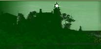
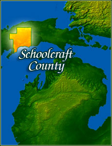
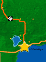
Our trip starts in Manistique and continues throughout Schoolcraft county. Being so centrally located to all the adventures we take in this wilderness we so respectfully call the U.P.   Manistique gives us the perfect home base for our adventures and travels across the Upper Peninsula and Schoolcraft County. Our Fantastic Fall Color Tour will take to some of the most beautiful areas the North Country has to offer.
From the Mirror of Heaven, The Rainy Nature Preserve, Canoeing the rivers and Hiking the pathways and discovering long lost trails, it is all here when we take you on the Worlds Greatest Color Tour.

Kitch-iti-kipi (The Big Spring)

Big Spring

1 hour // camera

« Watch Video Clip (3:16)

» Palms Book State Park

»directions from manistique: west on E Lakeshore Dr/US-2//turn right at M-149//stay on M-149 as it turns to the left//turn right at CR-455//turn right at Sawmill Rd./M-149//turn right at Fishingsite Rd 0.4 mi to Palms-Book State Park.

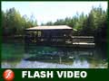
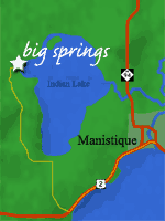
Kitch-iti-kipi, "The Big Spring" is the largest in Michigan - forty feet deep and over 10,000 gallons of clear water gush per minute from the fissures in the underlying limestone.

Bishop Baraga Shrine

Bishop Baraga Shrine

1 hour // camera

« Watch Video Clip (1:40)

» Bishop Barage Shrine - Manistique Tourism Council

»directions from palms book state park: northwest on Fishingsite Rd//turn left at M-149//turn left at CR-455//turn left at CR-442/M-149//turn left at Evergreen Beach following indian lake shore//slight left at CR-440//turn left at Arrowhead Rd 0.2 mi to Bishop Baraga Shrine

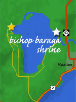
During his lifetime, Baraga founded many missions in northern Michigan. The original Indian Lake mission, the third of Baraga's faith, was built in anticipation of his first visit to the area in May of 1832. The chapel, built by local Chippewas, used traditional Indian construction methods and materials such as logs and bark.

Rainey Wildlife Area

Rainey Wildlife Area

2 hours // binoculars, hiking boots

« Watch Video Clip (2:11)

» Rainey Wildlife Area - Michigan DNR

»directions from bishop baraga shrine: northwest on Arrowhead Rd//Arrowhead Rd turns right and becomes Birch St and then becomes Golf Course Rd//Golf Course Rd turns right and becomes Country Club Dr//turn left at Dawson Rd//turn right at Wawaushnosh Dr
»from US-2 in Manistique, drive north through town on M-94 about 5 miles//turn left (west) on Dawson Rd and proceed 1.5 miles to an access road that goes north to the site parking lot.

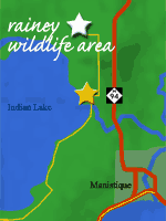
A hiking trail that passes through maple, yellow birch, and mixed conifer habitat takes hikers over boardwalks and through wet areas, leading to an elevated observation platform that provides a feeling of remoteness with outstanding opportunities for viewing wildlife.

Canoe Trip

Ted's Range Road Diner

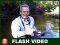
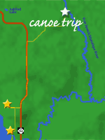
2-4 hours // canoe, canoe gear, paddles

« Watch Video Clip (5:21)

» Canoeing - Manistique Tourism Council

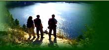
In all of Michigan there is no other area that offers the canoeist and Kayaker so many opportunities as Schoolcraft County. Whether you are a novice or an avid canoeist there is a body of water here for you.

Ashford Lake Pathway

Inglis Falls

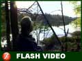
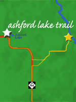
3 hours // hiking boots, compass, bottled water

« Watch Video Clip (3:38)

» Ashford Lake Pathway Map PDF (412 KB)

»directions from manistique: north on I-94 about 16 miles//I-94 will curve to the west, then back north, and then west again. Ashford Lake is on the north side of the second curve to the west//turn right into Ashford Lake Pathway parking lot.

Ashford Lake Pathway is known more for its cross country skiing than its summer and fall hiking. That’s ok because that means its another secret that only a few know about.

Colwell Lake Trail

Rider From Michigan

2 hours // hiking boots, bottled water, walking stick

« Watch Video Clip (2:45)

» Colwell Lake Recreation Area

»directions from ashford lake pathway: west on I-94 about 10 miles//turn right on access road to colwell lake trail.

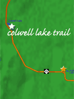
The Colwell Lake Trail begins at the boat launch parking lot. This natural surface, nature trail is 1.6 miles long and crosses through a variety of northern hardwood stands and wetlands. The trail has several areas where stairs or plank boardwalks are traversed.

Schoolcraft County Environmental Laboratory

Wiarton Willie

2 hours // hiking boots, gloves

« Watch Video Clip (3:30)

» Environmental Lab Map

»directions from manistique: east on US-2//turn left and head north on CR-433//turn left on Krummich Rd. (West) and follow until the roads curves to the south and ends at the entrance of the environmental lab.

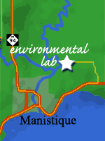
The Environmental Lab's purpose is for the environmental education of youths.  The property is located within three miles of most of the county's schools and contains a wide variety of flora, fauna, topography, soils and stages of succession.  Three state and federal grants, supported with local donations to match have allowed the project to develop and be successful. 

©2006 All Rights Reserved Home | Show Schedule | Travel Planner | Viewer Mail | Contact Us | Show DVD's